Toronto's Underground Secrets: Hidden Tunnels, Forgotten Spaces, and the City Below the City
A 6-minute journey through Toronto's hidden underground world and the fascinating infrastructure most visitors never see
Beneath Toronto's bustling streets lies a hidden city that most residents don't even know exists—a complex network of tunnels, abandoned infrastructure, buried waterways, and forgotten spaces that tell the story of urban development spanning more than two centuries. This underground Toronto isn't just about utility tunnels or subway infrastructure; it's a parallel world that reveals how cities grow, adapt, and sometimes abandon entire sections of themselves as they evolve. Understanding this hidden landscape transforms your perception of Toronto from a surface-level collection of neighborhoods into a three-dimensional urban ecosystem with layers of history literally stacked beneath your feet.
The PATH System: More Than Just Underground Shopping
Most visitors to Toronto encounter the PATH system as a convenient way to avoid winter weather while moving between downtown hotels, shopping centers, and attractions. But what they're actually experiencing is just the public face of North America's most extensive underground pedestrian network—a 30-kilometer maze that represents only the visible portion of Toronto's subterranean infrastructure. The PATH system that tourists see is built on top of, around, and through much older tunnel networks that date back to the city's earliest development.
To truly understand the PATH, we need to grasp how it evolved from practical necessity rather than central planning. Toronto's harsh winters created economic pressure for businesses to find ways to keep customers moving between buildings without exposure to the elements. Starting in the 1960s, individual property developers began connecting their buildings through underground passages, initially as private connections between specific properties. Over time, these individual connections grew into an interconnected network, but because it developed organically rather than through master planning, the PATH system retains the irregular, sometimes confusing layout that reflects its piecemeal origins.
What makes the PATH particularly fascinating from an urban exploration perspective is how it reveals the hidden connections between Toronto's power structures. The system doesn't just connect buildings randomly—it links the financial district's major banks, law firms, and corporate headquarters in ways that allow business elites to move through downtown Toronto without ever entering public spaces. This creates what urban sociologists call "parallel mobility infrastructure," where different social classes experience the city through entirely different physical pathways.
The most intriguing aspect of the PATH system for curious visitors involves the spaces that exist between the official network—service corridors, mechanical rooms, and abandoned sections that hint at the much larger underground infrastructure that supports the visible system. While these spaces aren't accessible to the public, understanding their existence helps you recognize that what you see as a tourist represents only a fraction of the underground activity happening beneath downtown Toronto.
Forgotten Waterways: The Rivers That Still Flow Under the City
Perhaps no aspect of Toronto's underground secrets is more hauntingly beautiful than the network of buried rivers and streams that continue to flow beneath the modern city. These waterways—including Garrison Creek, Taddle Creek, and dozens of smaller streams—were gradually buried and diverted as Toronto expanded, but they didn't disappear. Instead, they were enclosed in concrete channels and storm sewer systems, creating an invisible watershed that still shapes the city's topography and infrastructure in ways that most people never recognize.
Garrison Creek represents the most extensive of these buried waterways, flowing from the area around Christie Pits park, under downtown Toronto, and into Lake Ontario near Fort York. The creek's original route can still be traced by following the subtle valley that cuts through Toronto's street grid—if you know what to look for, you can see how streets like Crawford Street and Manning Avenue follow the creek's natural course, while other roads cross it at angles that reflect the original topography.
What makes these buried waterways particularly fascinating is how they continue to influence Toronto's development more than a century after they were covered. The underground flow of Garrison Creek still creates foundation challenges for buildings constructed above its route. During heavy rainstorms, the creek's underground course can become overwhelmed, causing flooding in basements and underground parking garages along its historical path. This creates an invisible map of vulnerability that shapes insurance rates, construction costs, and urban planning decisions in ways that most residents don't realize.
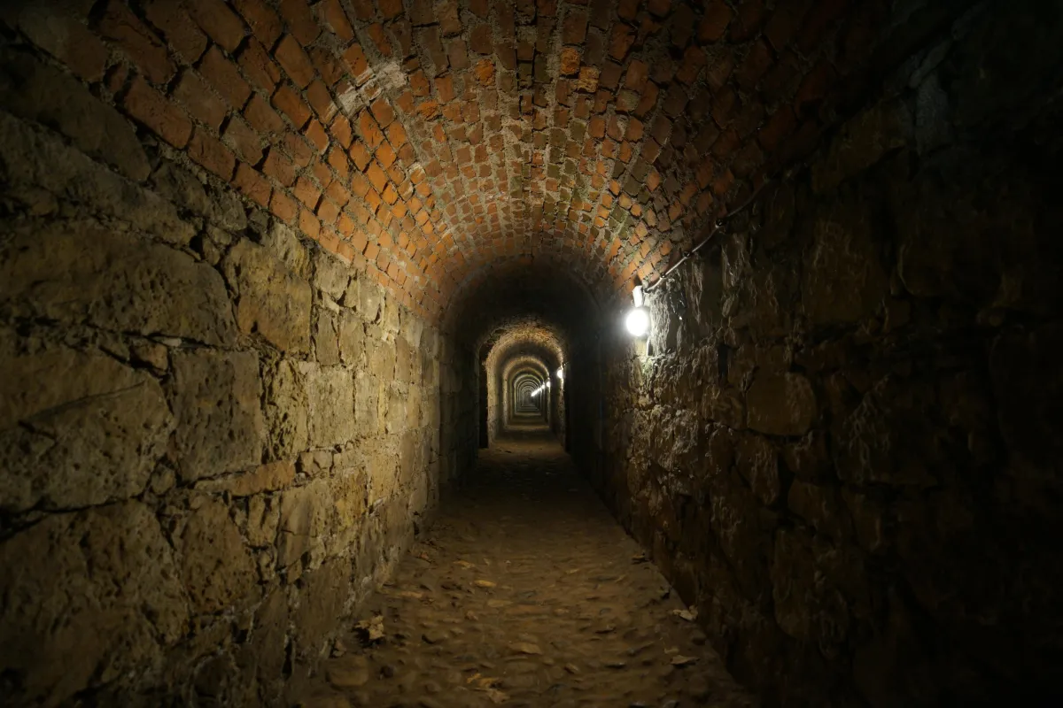
The engineering required to manage these buried waterways created some of Toronto's most impressive hidden infrastructure. Storm sewer tunnels large enough to drive trucks through carry the flow of these underground rivers, while complex pumping stations and overflow systems prevent the buried creeks from reclaiming their original surface routes during major storms. Some of these tunnels are accessible through guided tours offered by the city's engineering department, providing rare opportunities to see Toronto's underground river system firsthand.
Understanding the location and flow patterns of these buried waterways also helps explain some puzzling aspects of Toronto's above-ground geography. Parks like Trinity Bellwoods and Christie Pits follow the routes of original creek valleys, while seemingly random curves in major streets often reflect the historical presence of waterways that once meandered through the landscape.
Abandoned Subway Infrastructure: Stations That Never Were and Routes That Time Forgot
Toronto's subway system contains numerous abandoned or partially completed stations that offer fascinating glimpses into alternative versions of the city that might have existed with different planning decisions or economic conditions. These spaces aren't just empty rooms—they're time capsules that preserve architectural styles, urban planning philosophies, and technological systems from different eras of Toronto's development.
The most famous of these abandoned spaces is the Lower Queen station, a nearly complete subway platform that was built beneath the existing Queen station but never put into service. This station was constructed as part of ambitious expansion plans in the 1960s that would have created a downtown relief line decades before the current Ontario Line project. The station remains largely intact, complete with platform tiles, structural supports, and electrical infrastructure, frozen in time as a monument to urban planning decisions that were never implemented.
Even more intriguing are the "ghost stations" that exist along current subway routes—platforms or track segments that were built for future expansion but became obsolete when plans changed. Bay Lower station, for example, was built as part of an experiment in subway routing that operated for only six months in 1966. The platform still exists and is occasionally used for filming, but it represents a fascinating example of how urban transportation systems can evolve in unexpected directions.
The abandoned infrastructure also includes extensive tunnel networks that were excavated for subway lines that were never completed or were later rerouted. Some of these tunnels now serve as utility corridors or emergency access routes, while others remain empty except for the occasional urban explorer or maintenance worker. Understanding the location of these abandoned tunnels helps explain some peculiar aspects of Toronto's street layout, where seemingly random construction barriers or unusual building foundations hint at underground infrastructure that never fulfilled its intended purpose.
Cold War Secrets: Bunkers and Emergency Infrastructure
Toronto's underground landscape includes remnants of Cold War-era emergency preparedness infrastructure that most residents don't know exists. During the height of Cold War tensions in the 1950s and 1960s, Toronto, as a major North American city, was considered a potential target for nuclear attack. This led to the construction of various emergency facilities, communication bunkers, and fallout shelters that were designed to maintain government and emergency services function in the event of nuclear war.
While many details about these facilities remain classified, some information has emerged through declassified government documents and historical research. The provincial government constructed emergency facilities capable of housing key personnel for extended periods, complete with independent power generation, communication systems, and supply storage. Some of these facilities were built beneath existing government buildings, while others were constructed as standalone bunkers connected to the surface through innocuous-looking entrances.
The Toronto Transit Commission's underground infrastructure also includes emergency facilities that were designed with potential wartime use in mind. Certain subway stations include reinforced areas that could serve as fallout shelters, while the tunnel system itself was designed with emergency ventilation and communication systems that could support large populations during extended emergencies.
Understanding this Cold War infrastructure helps explain some seemingly over-engineered aspects of Toronto's underground systems. The extensive backup power systems, redundant communication networks, and unusually robust construction standards for many underground facilities reflect design requirements that went far beyond normal peacetime needs.
Hidden Utility Networks: The Infrastructure That Keeps the City Running
Beneath Toronto's streets lies an incredibly complex network of utility tunnels, service corridors, and maintenance facilities that keep the modern city functioning. This infrastructure includes not just the obvious systems like water pipes and electrical cables, but sophisticated networks for steam distribution, fiber optic communication, pneumatic mail delivery systems (some still in operation), and specialized infrastructure for everything from bank security systems to emergency communication networks.
The steam distribution system represents one of Toronto's most impressive but least visible infrastructure networks. Enwave's Deep Lake Water Cooling system and district heating network uses a combination of underground tunnels and buried pipes to distribute heating and cooling throughout downtown Toronto. This system includes massive underground facilities at the waterfront that draw cold water from Lake Ontario to provide air conditioning for major buildings, while also operating heating plants that distribute steam through underground networks.
The complexity of these utility networks creates what engineers call "subsurface congestion"—areas where so many different utility systems converge that there's literally no room for additional infrastructure without major engineering challenges. Understanding this congestion helps explain why construction projects in downtown Toronto often take longer and cost more than expected, and why seemingly simple tasks like installing new streetlights or traffic signals can require extensive coordination between multiple utility companies.
Legal Exploration: How to Experience Toronto's Underground World Safely and Legally
For visitors interested in exploring Toronto's underground infrastructure, several legal options provide access to these hidden spaces without trespassing or safety risks. The Toronto Transit Commission offers behind-the-scenes tours that include visits to normally inaccessible parts of the subway system, including maintenance facilities, control centers, and occasionally abandoned stations. These tours are typically offered as fundraising events or educational programs and provide professionally guided access to infrastructure that would otherwise be impossible to see.
The Toronto Historical Society and various urban exploration groups organize legal tours of PATH system extensions, buried creek locations, and historical sites that include underground components. These tours are led by knowledgeable guides who can provide historical context and explain the significance of what you're seeing, while ensuring that all exploration takes place in areas where public access is permitted.
Several downtown buildings offer self-guided exploration of PATH system connections that most tourists miss. The Commerce Court complex, for example, includes underground connections that showcase different architectural periods and planning approaches, while the Eaton Centre's lower levels include remnants of older infrastructure that hint at the site's historical development.
For those interested in Toronto's buried waterways, several parks and ravines provide access to areas where underground creeks occasionally surface or where historical creek beds remain visible in the landscape. High Park, Trinity Bellwoods Park, and the Don Valley ravine system all include locations where careful observation reveals evidence of Toronto's hidden watershed.
The key to safe and legal underground exploration in Toronto is preparation and respect for private property and safety regulations. Many of the city's most interesting underground spaces are accessible through official channels if you know how to find and request access. Understanding the difference between publicly accessible areas and restricted infrastructure ensures that your curiosity about Toronto's hidden spaces leads to educational experiences rather than legal problems.
Toronto's underground world represents layers of urban development, abandoned dreams, and hidden infrastructure that continue to shape the city in invisible ways. While much of this underground landscape remains inaccessible to casual visitors, understanding its existence and significance transforms your perception of Toronto from a surface-level tourist destination into a complex, three-dimensional urban ecosystem with secrets waiting to be discovered through legal and educational exploration opportunities.
